Friday, April 19, 2013

Metamorphoses: St. Kitts, St. Martin, and Puerto Rico

Christopher Columbus had quite the Caribbean cruise the year after first "discovering" America by landing within the Bahamas Archipelago: In 1493, he also "discovered" three beautiful islands, known today as St. Kitts, St. Martin, and Puerto Rico. Sadly, his advances for Spanish Imperialism marked the beginning of the demise of the islands’ peaceful native inhabitants. The eventual global greed for sugarcane, tobacco, and cotton brought slavery and resource depletion to these beautiful and self-sustaining islands.

Don’t grieve. Anything you lose comes round in another form.

                                                                                      —Jalal-Uddin Rumi


Fast forward 520 years. 


As I listen to classical music inside a butterfly farm on the French side of St. Martin, I feel like Alice in Wonderland among hundreds of fluttering exotic species of butterflies and moths. On many of the exotic plants caterpillars engage in their eating binge, which yields better results for them than it would for a human. The Butterfly Farm [www.thebutterflyfarm.com] protects the chrysalides from predators so the newly minted butterfly can emerge and safely dry its wings before taking flight. Reflecting on the 500-year turbulent history of these Caribbean islands, I think the peaceful butterfly farm, illustrating the caterpillar’s transmutation, poetically symbolizes the triumphant story of these islands’ metamorphoses.


St. Kitts: From Sugar Cane Trains to Scenic Railroad

St. Kitt’s is the affectionate name for the island originally known as St. Christopher. 

Conflicting stories emerged regarding the name’s origin: Columbus named it after either himself, or the patron saint of travelers. He never stopped at this volcanic island with the fertile soil, fresh water, abundant forests, and salt. Starting in 1643, when sugarcane had the same worldwide commodity status as oil does today, this West Indian outpost juggled settlements from Spain, England, and France, which were not without bloodshed. Eventually the British had complete control, and St. Kitt’s became one of its wealthiest possessions until sugarcane prices dropped. 


This downturn in economics led to the 1926 construction of a narrow-gauge railway around 

the island to bring in the sugarcane from the outlying estates for processing. Through economies of scale, the railway allowed sugar production to continue on St. Kitts much longer than on other islands. The island’s sugar production ended in 2005 after 350 years.


Not all was lost with the railway, though. Starting in 2003, the St. Kitts Scenic Railway
currently shuttles tourists around the entire island. The double-decker train allows for canopied panoramic views of the island on top, and enclosed viewing down below. The conductor broadcasts the history of the island along with points of interest while the free-flowing adult beverages enhance the vacation feeling. The islanders give friendly waves as the train whistles through the dry or lush landscapes, depending on the side of the island. Also visible are many remnants of the old sugarcane industry, including the old windmills.


St. Martin: From Slavery to Tourism


Columbus also did a "sail by" of the Isla de San Martín, on November 11, St. Martin Day. Spain was never that keen on this island until after the French and Dutch created trading settlements, and the Dutch stronghold threatened Spain's salt trade. Then, after years of war and changes in the trade, Spain abandoned it in 1648. After some bickering between the French and the Dutch, they split the island [not exactly 50/50] into its current respective boundaries.

The Spanish first imported slaves to the island, but not in large numbers. The cultivation of cotton, tobacco, and sugar, however, caused the importation of mass numbers of slaves to work on the plantations. The French finally abolished slavery in 1848, and the Dutch

followed suit 15 years later. After slavery ended, St. Martin experienced an economic depression until 1939, when it was declared a duty-free port. Today, it serves as a tourist playground for all nationalities, with its beautiful beaches, diving, and of course, butterfly farm. The beaches beckon, with their beautiful cream-colored sand and dreamy-blue water. On both the Dutch and French sides, massive complexes of beachfront resorts are situated between stretches of vacant land, that unfortunately serve as a wasteland for discarded beer bottles. Overall, though, to continue the butterfly analogy, the island appears to be in the final stages of emergence from its chrysalis. It is clear what type of butterfly it is, after it has had time to dry its wings and fly.


Puerto Rico: From Agriculture to Manufacturing and Tourism


Columbus actually visited this island, which he originally named San Juan Bautista. The natives who greeted him probably regretted their decision to show him gold nuggets in the river and tell him to take all he wanted. This discovery for Spain must have been like Spindletop to the Texas oil industry, and the island was renamed Puerto Rico ("rich port"). Like the other islands, slaves were imported from Africa as Puerto Rico began producing cattle, sugarcane, coffee and tobacco. The slaves were emancipated in 1873, and in 1898 that Spain ceded Puerto Rico to the United States under the Treaty of Paris. 

The decline of the sugar industry also affected Puerto Rico’s economy. Operation Bootstrap, a plan by the U.S. government, developed Puerto Rico’s economy into a leading manufacturing and tourist destination. While walking the narrow brick streets of Old San Juan, one can see the juxtaposition of events with the colonial and modern architecture alongside one of its many forts. The afternoon siesta time in the port town had a heaviness from the heat and felt hollow–like the real life was somewhere else. Perhaps the butterfly had already taken flight.


Circumstances change, and are often beyond our control. Hope emerges from the possibility for transformation.

What the caterpillar calls the end, the rest of the world calls a butterfly...

--Lao Tzu


All photos by ndm

Wednesday, January 2, 2013

Singing the [Colors of the Caribbean] Blues


As the Northern Hemisphere welcomed winter and the end of the Mayan calendar drew nigh, the idea of soaking in some salty air and island scenery with a coconut drink felt appropriate. Each day the wispy and fluffy white clouds painted imaginary scenes across the sky, but my attention always came back to the ocean's colors: The sharp contrasts of blues tantalized the eyes like spices do to the tastebuds, and the variety would make a Crayola box envious.

These photos barely do justice to the waters along the Mesoamerican Reef System, the second largest barrier reef in the world--Wedgewood and Tiffany blue strips layer between deep bands of lapis.  In other sections, the light sand begins a progression of blues for which the color descriptions could be a gemstone casting call: aquamarine; turquoise; sapphire; and tanzanite.  And all this against a backdrop of cobalt and azure skies. 

The sailors and pirates of yore who first plumbed these waters were not seeking pigment inspiration for their inner artist; they were raiding, smuggling, pillaging, and enslaving. Then, colonists and missionaries arrived with their own agendas. Now, the tourists and expats visit seeking scuba sites and cheap coconut drinks. Regardless, nature keeps showing up with her beauty. Once you get past the natives peddling for everything, including prescriptions (one tourist was dismayed to learn the pharmacy was out of both testosterone and Viagra!), you can settle in for a picture perfect paradise.

Roatan, Honduras
Although geographically Roatan belongs to Honduras, culturally, the natives will distinguish themselves from the mainlanders. On this roughly 35-mile-long island, English is the primary language, and Spanish secondary, which is the opposite of Honduras. Many of the islanders descended from the British Isles, and due to the colonization, many of the towns and residents have English names.  


Although the island exports a lot of fish and iguanas, its economy relies on tourists who come to access the legendary diving at both the barrier reef and the various shipwrecks around the islands.


Belize City, Belize 
In the mid-17th century British lumber harvesters, needing a strategic trading post/port with access to the sea and local rivers and creeks, founded Belize Town, which had previously been a small Mayan city called Holzuz. Belize has been an independent nation since 1981.

Belize also attracts both scuba divers to access some of the 300km of the 900km barrier reef, and tourists to see Mayan ruins and beautiful beaches. In addition to a large ex-pat community living la dolce vita on a nearby island, Belize is also home to Mennonites, who came here in 1959 to escape religious persecution. They also created my tour buggy [see pic].

The Belize people readily express pride in their country, and are quite generous with their smiles, coconuts, and One Barrel Rum [with lime for the coconut].  At  a tasty chocolate factory tour [MOHO chocolate], you can support an indigenous and sustainable local economy while also making your own chocolate bar. Another popular historical landmark is Belize City's swing bridge. This bridge, the oldest in Central America and one of the few manually operated, still functions. This bridge has been rebuilt after three major hurricanes, but mainly for the tourists. River traffic has waned over the years, and so now the bridge only opens upon special request.  It requires a minimum of four men to crank it by hand until it is parallel with the river, and then it has to be hand-cranked to its original position.  For Christopher Walken fans, this is the bridge shown in the 1980s film, The Dogs of War.

Costa Maya

Costa Maya is a small fishing region in the state of Quintana Roo, Mexico, which encompasses two villages– Mahahual and Xcalak. There is a small Mayan temple, a remnant from the Mayan tribe that inhabited this region from 200 BC to 900 AD.  The beach truly marks the beauty of this area.


Although it was devastated by a category 4 hurricane in 2007, the Senor Frogs has been rebuilt in the Mahahual region. Rather than being lulled to a nap by lapping waves, breezes, and swaying palms, one's heartbeat can instead compete with the techno music and DJ thumping from the swim-up bar.  I recommend walking a mile to the other end of the beach, where you can eat fresh ceviche and guacamole, soak in the colors of blue, and contemplate how you'd like to spend the days after the end of the Mayan calendar.  


all photos by NDM, 2012. 

Saturday, December 8, 2012

65 Degrees North: The Magic Continues


"Not all those who wander are lost." J.R.R. Tolkien


On an icy cold Thanksgiving afternoon, this quote comes to mind as I soak in the scenery from my perch on a beautiful Icelandic horse: Stark white snow sprinkled on a moonscape of lava rock, shrubs, and lichen-hugged rocks. The stillness and the light plays tricks on the eyes and could explain why Icelanders believe in elves, trolls, and dwarfs.  It all feels familiar to me, and not just because I have visited here before.  The familiarity embraces me like a cozy fleece. My mind feels free to wander and right at home; perhaps I'm reminded of my childhood passion for the Lord of the Rings. (Tolkien read Icelandic poetry and sagas in Old Norse, the basis for the Icelandic language, and he incorporated into his works the names and places described in contemporary travel memoirs.)  As my horse maneuvered the icy, hilly, trails with [thankfully] spiked shoes, she would skit or glance at "nothing" in the landscape.  "Elves," my guide said matter-of-factly.  I felt a peace like floating, between space and time. Home.


Less than an hour's flight from Reykjavik, at just over 65 degrees North latitude [just at the Arctic Circle] lies the city of Akureyri. Known as the capital of northern Iceland, Akureyri's location on the west inland side of a fjord made this a perfect trading center in the 9th century.  As an official city, it recently celebrated its 150th year. [see additional picture, below] 


Like other places in Iceland, it offers mountain views and geothermal pools, perfect for warming up while outside in the subfreezing temperatures. This year Akureyri had an unseasonably early and plentiful snowfall, with a blizzard in early September and heavy snowfall in the three weeks prior to my arrival. 


Northern Lights
My quest to visit north involved viewing the Aurora Borealis. 
To witness this phenomenon requires timing, patience, clear skies, and a location far from any ambient city light.  For future reference, a giant tour bus parked on the side of the road does not provide the optimal viewing, especially on a night with a nearly full moon. On my particular viewing night, the sky clarity was low--about 2 on a scale with an optimal 5.  When the auroras did appear, though, like slow-motion fireworks, it felt like the scene from Close Encounters when the spaceship arrives.


Lake Myvatn
About 1.5 hours' drive from Akureyri, the area of Lake Myvatn is a Fire & Ice wonderland.  After living in a concrete jungle for over a year and a half, I was mesmerized by the pristine, uninhabited, treeless landscape.  Lake Myvatn, created by a volcanic eruption about 2300 years ago, most likely earned its name-- "lake with way too many flies"--in the summer, a time for hiking, biking and observing birds. In the winter, it just waits for people to take pictures. 

Mudpools, Fissures, Craters, and Pseudocraters

The area around Lake Myvatn has some notable volcanic sites:

Hverfjall Crater

To the east the contrasting white snow, cobalt-blue skies, and pink tufted clouds tempers the Hverfjall crater's dark towering presence.  


Boiling mudpool


Nearby is Krafla, an area with 29 reported eruptions in recorded history, which also sources geothermal energy used by a nearby power station.  The area surrounding Krafla, with boiling mudpools and steaming fumaroles interspersed between snow and ice, made me feel like I was an extra on the set of a Star Trek episode.  


At Skútusstaðir lies a pseudocrater, which is formed by steam explosions when hot lava crosses a wet surface; it resembles a volcanic crater, but is not an actual vent for lava eruptions.  [see picture below]


In a nearby fissure is Grjótagjá, a small lava cave housing a thermal spring, which served as popular bathing site from the 18th century until the mid- 1970s when nearby eruptions elevated the temperatures above 122 degrees Fahrenheit. 


Many farms pepper the landscape, including a lakeside one owned by our tour guide, who introduced his woolly residents. Iceland's famously warm wool has been a trade staple since its earliest settlements. 


Dimmuborgir
Although Iceland converted to Christianity a while ago, animistic beliefs, a Nordic/Gaelic/Viking blend, still exist in today's culture. Some of these beliefs were revealed at a place just near Lake Myvatn called Dimmuborgir, or Dark Castles.  The suitable name describes the lava field formations and volcanic caves resembling the ruins of old castles. These craggy formations, which seemed much more dramatic in the winter landscape, can be explained scientifically due to lava merging with lake after an eruption to the east about 2300 years ago.  However, the formations have more interesting non-scientific explanations that inspire Tolkien-esque stories. In Nordic Christian lore it is the place where Satan landed when he was cast from the heavens and created the apparent "Catacombs of Hell".  In Icelandic folklore, Dimmuborgir is said to connect earth with the infernal regions. Local lore, though, according to our tour guide, explains that the rocks were formed after a bunch of trolls partied all night, and were turned to stone because they did not get home before sunrise. [And Princess Fiona in Shrek thought she had issues at sunrise!] Just like on a summer's day you can "see" figures in the clouds, while walking the trails here, you can imagine the faces of trolls in the rock formations. 


Dimmuborgir also serves as the residences for the Yule Lads [thirteen in total], who awaken from hibernation in the days before Christmas. On the day I visited, two of the lads greeted [or, in the case of a few children, scared], danced, and gifted us each with a candle. I posed for a photo with the [as translated] the lads named 'pot licker' and 'sausage swiper.'


Godafoss
A trip to Iceland must include viewing a waterfall and soaking in geothermal-heated lagoons. The Myvatn region has two waterfalls: Detifoss and Godafoss. Unfortunately, a visit to Detifoss was thwarted by the filming of 'Game of Thrones.'  Godafoss, though, delivered in the awe department.  Godafoss, or "waterfall of the gods," was the place into which the head of Iceland threw the Norse god statues when Iceland converted to Christianity in the year 999 or 1000. Although it must be spectacular in broad daylight, even in wintry conditions at dusk, Godafoss has immense power and beauty.  While standing on an icy platform, my senses tingled from the visual spaciousness, the pure air, the mist, the rumbling, and the feeling of being at the edge of the universe. After a exciting day of romping in the snow and on the ice, a nice soak in the warm, soothing waters of the Myvatn Nature Baths, which contain a unique blend of minerals, silicates and geothermal microorganisms, felt so relaxing. 

At 65 degrees North, I am not lost; I am feeding my wanderlust. The magic continues.


smoking fumaroles


Downtown Akureyri


Skútusstaðir pseudocrater


Sunday, April 22, 2012

The Bronx: Arthur Avenue


As strange as this may sound, my first three visits to The Bronx were all for fitness-related reasons: a Bronx Zoo run; a 5 Borough Bike Ride; and a Merrell Mud Run. My most recent adventure to The Bronx, however, was inspired by a purely pleasurable reason: to eat Italian food.

Most people associate Manhattan's Mulberry Street with Little Italy. There you can certainly experience the few remaining streets of the old Italian immigrant neighborhood, replete in its Italian restaurants, gelato stands, and souvenir vendors, but it feels more like an overcrowded theme park visit. For a real Italian neighborhood adventure with goodies to bring home and cook, then the trek out to Arthur Avenue is well worth it.

My adventure began with a 1.5 hour subway ride, which wound its way through more culturally diverse neighborhoods than the World Showcase at Epcot Center by starting from lower lower Brooklyn [my Italian neighborhood] all the way up to Fordham Road in The Bronx. Unfortunately, one un-Disney like moment involved observing a purse snatching and the victim's perfectly executed efforts at self-defense.  

The colorful walk from Fordham Road to Arthur Avenue makes it glaringly obvious you are not in Brooklyn anymore. On Fordham University's Rose Hill campus, solemn Revival Gothic architecture stands in contrast to the verdant nearby sites of the Bronx Zoo and the New York Botanical Garden. In a few short walking minutes, though, the Belmont section of The Bronx offers an Italian eating mecca at Arthur Avenue and about 187th Street. 

Your trip could be divided into two separate objectives: noshing and food shopping. If you threw a rock you would hit a number of churches and places to eat. This first visit was more of an experience-through-noshing-and-shopping trip than a sit-down-for-a-four-hour-stuff-yourself-silly-meal one. So, rather than review every place I visited and every item I brought home to cook, I am sharing some snippets of the overall experience: Walking the neighborhood on a beautiful sunny day brought encounters with a few Italian speaking gentlemen, some with cigars, some just with smiles, just as any visit to an Italian village would; standing in line at Casa Della Mozzarella or Borgatti's for fresh pasta, introduced me to well-heeled Italian ladies from all over the five boroughs, New Jersey, and Long Island, who regularly come to Arthur Avenue because they swear the food is so much fresher; and talking to the Calabrians at the Arthur Avenue Retail Market while they ply me with samples of their homemade mozzarella, ricotta, salume, reduced balsamic vinegar, and wine, taught me the virtues of properly storing fresh mozzarella with New York's finest tap water versus that impure 'crap' in the 'burbs. 

The best souvenirs for those who cook come from the numerous stores sprinkled in between restaurants and cafes.  All types of fresh seafood are available [this is a popular location to buy ingredients for the Feast of the Seven Fishes], and you can even indulge that craving for fresh oysters served at a stand-up sidewalk counter outside the store!  

The markets sell giant cans of San Marzano tomatoes and arborio rice in large bags at incredibly low prices.  [See photos above]


The bakeries display an unbelievable array of every type of Italian cookie, including my favorite pignoli cookies and biscotti, in addition to the freshly baked bread with aromas guaranteed to revisit you in your dreams. Some of the fresh produce is even sold straight from the van! 

Bring a cooler, cash, and an appetite. Arthur Avenue will supply the rest.

Sunday, November 27, 2011

Iceland

It’s 10 a.m. and still dark outside. Pitch black. Of course, in November I should expect this at 64 degrees latitude in the northernmost capital of the world. Iceland is old, yet everything feels and smells new. The crisp, cold air invigorates the lungs. As my luck would have it, the first snow of the season started the day I arrived and kept delivering throughout my trip. It did add to the surreal scenery, though. Imagine jet black volcanic rocks sprinkled with dusty snow complementing the thick billowing slate-grey snowladen clouds floating in an ethereal twilight blue sky.


Reykjavik
Reykjavik comes from the old Norse meaning smokey bay. Technically, it should be steamy bay, but who wants to argue with a Viking captain’s assessment over a thousand years ago? The smoke that the Viking captain saw was actually steam coming from the ground.  These steamy plumes evidence an undercurrent of geothermal activity throughout the geography and history of Iceland.

Roughly 65% of Iceland’s 300,000 people lives in the capital.  Once you leave the city, you see absolutely nothing but pristine land.  The city itself does not even look that overpopulated [relative to New York, anyway].  The mild temperatures [only freezing] remain consistent throughout the winter here because it is on the water and benefits from the Gulf Stream.  Many Icelanders said the winters used to be much worse thirty years ago. They are much colder inland, though, with some arctic circle windchill and winds across the glaciers that comprise 11% of the 103,000 square kilometers of this island. Global warming or not, it is just a cycle and Iceland is certainly not overly contributing to its carbon footprint: Geothermal heating provides heats to over 85% of the homes; hydroelectric power provides the electricity.  Geothermal energy also heats the greenhouses used to grow some of their vegetables, and also makes some phenomenal spas [see below].  Reykjavikers get around by car, bus, foot, and bicycle, even in the snow, along the plentiful and wide trails throughout the city and along the shoreline.  


I walked along one of these trails into the downtown area. The huge Tjornin pond and park are a nice backdrop to the National Gallery, a church, and some other city buildings.  The somewhat gloomy looking Hallgrimskirkja Church was an easy orientation landmark as I walked around because of its stark grey tall steeple. (I chose not to go up to the top because it is open-air and that day was particularly windy).  The other landmark for my walk was the Perlan (the Pearl) perched upon a hilltop; this glass domed restaurant, café, and museum definitely puts lipstick on some otherwise ugly hot-water storage tanks.


The main shopping street, Laugavegur, is a cross between Rodeo Drive and any town’s main street. With cute European style coffee shops every other block [no Starbucks] and plenty of Icelandic designer boutiques and restaurants, you could very easily stock up on warm outerwear made in Iceland and spend a small fortune.  Every side street along here had picture perfect views of mountains.  


So, too, did the newly constructed Harpa concert hall and convention center. To add to the beauty, this area smelled good: clean air with a hint of salt mixed with the aroma of baking bread, roasting coffee, and cooking.  Maybe I have been living in New York too long, but this was a nice bonus.  


Prior to this trip, if you had told me that I would ever go running in the snow in 20-degree weather, I would have laughed. However, the beautiful tree-lined trails to the shore were irresistible to me and about five other runners.  The trail passes by a geothermal beach called Nautholsvik. In the summer this is a sunbather's paradise where the sea water is heated, albeit artificially, from the energy plant. Although it is touted as the only sandy beach in Iceland, the research revealed the golden sand is actually imported from Morocco. It is still beautiful at sunrise, though, with rosy pink tufts of clouds in the steel blue sky. 


Iceland & Geology
There is no doubt this is a volcanic island.  Once you leave the city limits, you can see ample evidence in the mountains, craters, and steam releasing from the ground.  This island actually straddles two tectonic plates: the North American and the Eurasian. Thus, a little movement here and there, and you have some pretty interesting grumbling below, and then above, the surface.  This shifting does create extraordinary rock formations and natural wonders, along with a handy natural water filtration system. 


Prior to my visit I had visions of the scenery from pictures and from some novels I was reading by the Icelandic author, Halldor Laxness [the only Icelandic Nobel Prize in Literature recipient]. I expected to see a cross between mossy heaths and something out of a J.R.R. Tolkien story.  My expectations were not too far afield.  On one bus trip outside of the city limits, I groggily awoke from a quick doze, and thought I had landed on the moon.  The contrast of the stark white snow with the jet black lava rock in the midst of nothing but sky and clouds astounds the senses. As the sun was setting [early of course], an eerie twilight glow in the sky makes it easy to see why so much of Icelandic myth and lore includes trolls, goblins and elves; long cold periods of darkness could certainly make the sane hallucinate.


The Geyser


This is THE Geyser. The Geysir in Icelandic is the one after which all others are named. In the midst of a snow laden field lies this breathtaking geyser park that may be difficult to fully describe without doing it an injustice. This area is termed a high temperature geothermal zone because the systems exist in a zone of active rifting and volcanic activity with temperatures in the subsurface higher than 200 degrees Celsius at less than 1 kilometer of depth. Unfortunately the actual Geysir doesn't blow any more because in the 1950s some tourists put too many rocks in it and plugged it up; however, the nearby Strokkur [the churn] geyser did not disappoint. Every 7-8 minutes, sometimes with a double expulsion, it erupted.  The rest of the trail winds around several smaller geysers, and colorful little pools of mud and steam, with the not-so-subtle aroma of sulfur.


The Golden Waterfall


Gulfoss is stunning to the ears and eyes. Unfortunately, the snow drifts and cold wind made the viewing and my photos difficult. On a sunny day, though, the sunlight through the falls is supposed to give a golden glow. The pounding rush of the falls feels like a drum through my body; after descending a long staircase, I made a duck walk [it is pretty icy] to the viewing points. The falls cascade over a type of staircase and then bend around to another point and rush into a  100+ foot crevice.  The cascade churns up quite a frothy mist and viewed through the snow drifts, it appears as though it is rushing into the clouds.  This was actually the only point  on the trip I felt unbearably shivering cold. [I am grateful, though, for my new heat-generating thermals!]


Pingvellir/Thingvellir [the Icelandic letter looks like a Olde English P and has a slight th sound]


This National Park is a must-visit place for any geology fan. Because we were racing against daylight at this point of the tour, the pictures were taken in the final hours of twilight.  The photographs also have the added hindrance of large snowflakes.  Despite all of this, this magnificent place instills such a feeling of awe. Thingvellir is a UNESCO site not only because it has one of the few clearly visible fault lines and rift valleys [between the North American and Eurasian tectonic plates], but because it also has the landmark of the world’s first democratic government. 


The Vikings picked this location as the meeting place for their law making body in the year 930. They continued to meet every three years here at the designated Law Rock to discuss the laws and any issues of the day.  This spot remains a sacred site for Iceland; this was the site where, on June 17, 1944, Iceland declared its independence from Denmark and became a republic. 


Additionally, though, this park has rock formations, fissures, and valleys you could spend an entire day hiking. It is also possible to say that you more-or-less traveled from Europe to North America in less than half an hour.  The park has places to view the Almanna Gorge [Everyman’s Gorge], the rift valley [separation between the plates] and also Raven’s Gorge.  Looking out over the rift valley during the last moments of light with the falling snow, I felt this incredible stillness. I have never been to space, but if I were to imagine what it felt like, it would be this. 


The Hot Springs
The Blue Lagoon


Blue Lagoon Spa is like the Disney World tourist attraction of Iceland. Like Disney, it does not disappoint at all.  Although Iceland has many hot spring spas and swimming pools, the lagoon has many unique characteristics.  First of all, the drive out to the spa has scenery that reminded me of a lunar landscape.  There is nothing around except white mountains and dark lava rock sprinkled with snow.  Then, out of nowhere, there is a road leading to the spa, which is built into the lava rock, and the entrance to the milky blue lagoon.


After a shower, you put on your swimsuit, walk outside and immerse yourself into water that looks like it belongs in a witch’s cauldron. The milky blue water has steam coming off it; against the gray clouds, the experience feels quite ethereal.  The water is warm and cozy. You can crab walk your way around the lagoon to stay immersed. Find one of the buckets with the white silica mud and slather it over your face, neck and shoulders. Continue your crab-cruise around the lagoon and feel your toes either squishing into soft sediment or resting on the hard lava rock.  At several places in the lagoon you can feel burst of geothermal currents, too. 


moss at Geysir to give you the idea
The lava around the area was created in 1266 [not a typo] and was called evil lava because it was so darn hard. In the summer it is covered by beautiful moss.  Although it was covered by cold snow on this visit, the scenery was still beautiful, especially as the sun set.  The lagoon actually sits between the two tectonic plates, so the water that is churned up from the center of the earth, a primordial algae, mineral, and silica soup, is pretty old, and apparently good for your skin. The water recycles every 40 hours and no bacteria can live in it, so nothing else is added to it. I never learned exactly why the water was blue, but it was definitely relaxing.


They do offer in-water massages at the lagoon. You can also indulge in some algae  masks and a volcanic pumice scrub from the 'bar" on the edge of the pool that also serves beer and wine. Outside the lagoon pool you can take in in a sauna and a steam bath.  The entrance to the steam bath room looks like Bilbo Baggins’s front door. You enter the room built into the lava rock and immediately notice the sulfur smell. After a few seconds of relaxing into the caressing heat, you are jolted alive by a burst of steam from the belly of the earth; to say it is hot would be an understatement. After a few hours at the lagoon I felt like every pore and every layer of my skin had been detoxed. I also slept like a rock that night.


Fontana
My second steam bath experience was at the newly opened Fontana hot spring wellness center in a town called Laugurvatn. The town is named after the spring-fed lake and the hot springs and geothermal steam for the spa are right on the lakeshore.  The outdoor pools, one at 32 degrees Celsius and one at 40 degrees Celsius, both have ample views of the lake. The sauna also has a huge glass wall for bathers to view the lake. The day I visited, it was snowing and gray, so the view may be more stunning on a clear day. The steam baths here were definitely hotter with more frequent heat bursts.  They also had a stronger sulfur smell. The entire experience felt relaxing, though, and it kept me warm for the rest of the day. 


Hotel Natura at high noon!
My hotel also had a spa with a little sauna, a steam bath that smelled like lavender [nice!] , and a geothermal heated pool and hot tub. With simple design [think IKEA meets ScanDesign], natural artwork, and mellow music piped in [neither Bjork nor Enya], the whole experience fulfilled its promise to relax.  


Animals
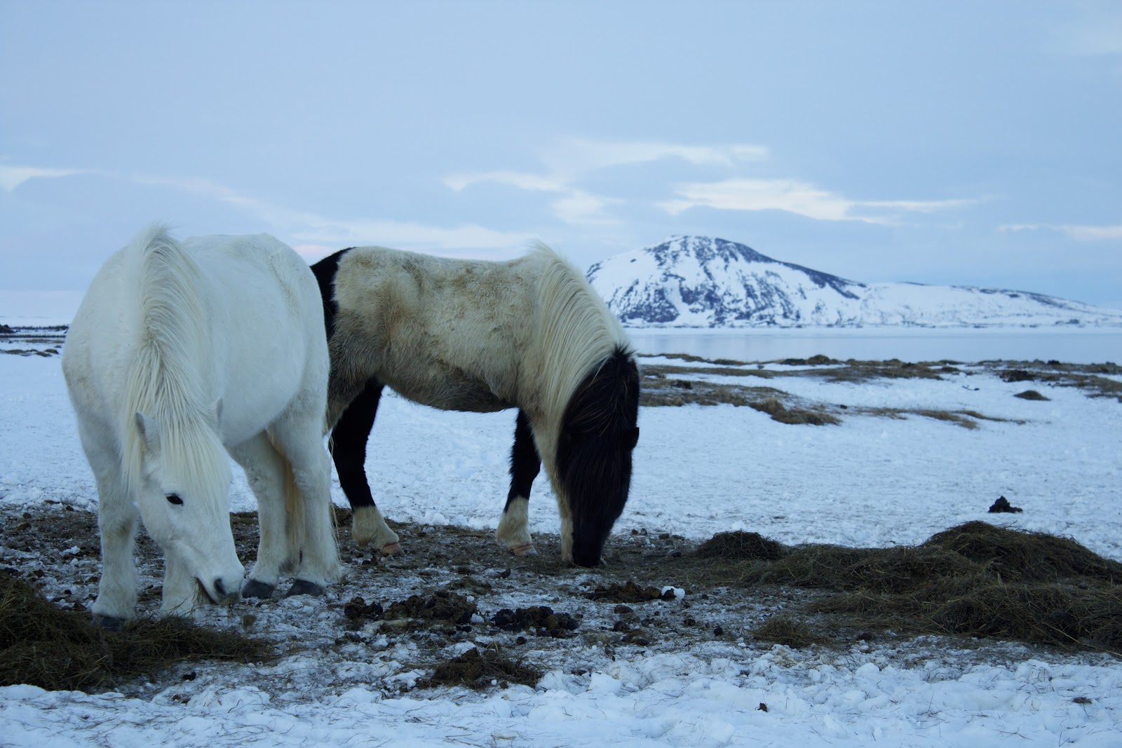
The Norwegians, Dutch, and Danish brought all kinds of animals to Iceland.  They have sheep, cows, pigs, dogs, and cats. (The cats, by the way, genetically link to Ireland, which is where many of the Vikings picked up their women en route to Iceland).  There are more sheep than people on this island, and quite a few cows and horses. The horses are quite cute and stout, and apparently hardy enough to stay outside all winter. They allegedly have their own special gait pattern, too.


Food
In addition to the livestock and obvious abundance of seafood, Iceland has its greenhouses for some of its produce.  The breakfast buffet had a certain European flair to it: 4-minute and 6-minute boiled eggs; ingredients for open-faced sandwiches, including sliced cheese, pate, processed meat, and cheese spread with shrimp or mushrooms; pickled fish; a shot of fish oil; muesli; fruit; skyr (absolutely delicious whipped yogurt); waffles; and beans and franks.  A lunch buffet one day was a good way to taste, without committing, to some unusual pickled salads and overcooked meats.  I will not say my body appreciated some of my commitments, but this is part of the travel fun. I was unable to try the famous lamb hotdogs at the Harbor, or the items on the menu board pictured at left.  I will say, though, that the arctic char, smoked lake trout, and bread are delicious. 


I do have only a reserved thumbs up for the bread baked in the ground that a local art gallery owner in Laugurvatn shared [see pic at right].  If you want to try it yourself, make your bread, put it in a cardboard container, wrap it in a plastic bag and bury it for 24 hours. Icelanders obviously enjoy pastries and sweets; I saw no shortage of bakeries or confectioners here.  They do have these healthy pumpkin sunflower seed cookies I could not get enough of...


Language & Lore
The Vikings settled Iceland in the year 871 plus-or-minus two years. (This is the name of a current exhibit in Reykjavik). The Icelandic language is a separate and distinct language with 32 letters and similar to the language spoken by those early Vikings. It is said that Icelanders could actually understand some of the ancient texts; Norwegians today would not be able to understand them.  Much of the history of the Iceland was written down early on in books known as the sagas, which resemble the tales told in epics like The Odyssey.  Iceland also has great fairy tales of legends and lore, recounting tales of trolls and giants.  One evening the hotel where I stayed hosted a pajama party with hot chocolate and an actor came in and read bedtime stories to us. He read a little from the sagas, and told us about the Icelandic Christmas stories, which have 13 “Christmas Lads” that bring presents in the 13 days prior to Christmas, like Santa Clauses, if the children are good. The storyteller also read a cute children's book about giants, which had a similar thread of animism and a moral, like any good fairy tale should. 


My trip to Iceland felt like a fairy tale.  On the bus ride back to the airport, I watched the sun setting low on the horizon behind the most evocative clouds.  In the opposite direction beneath the slate-grey sky I saw a few boats on the water; then, as if on cue, the clouds parted slightly and a giant rainbow appeared. Fairy tale indeed.