Sunday, November 27, 2011

Iceland

It’s 10 a.m. and still dark outside. Pitch black. Of course, in November I should expect this at 64 degrees latitude in the northernmost capital of the world. Iceland is old, yet everything feels and smells new. The crisp, cold air invigorates the lungs. As my luck would have it, the first snow of the season started the day I arrived and kept delivering throughout my trip. It did add to the surreal scenery, though. Imagine jet black volcanic rocks sprinkled with dusty snow complementing the thick billowing slate-grey snowladen clouds floating in an ethereal twilight blue sky.


Reykjavik
Reykjavik comes from the old Norse meaning smokey bay. Technically, it should be steamy bay, but who wants to argue with a Viking captain’s assessment over a thousand years ago? The smoke that the Viking captain saw was actually steam coming from the ground.  These steamy plumes evidence an undercurrent of geothermal activity throughout the geography and history of Iceland.

Roughly 65% of Iceland’s 300,000 people lives in the capital.  Once you leave the city, you see absolutely nothing but pristine land.  The city itself does not even look that overpopulated [relative to New York, anyway].  The mild temperatures [only freezing] remain consistent throughout the winter here because it is on the water and benefits from the Gulf Stream.  Many Icelanders said the winters used to be much worse thirty years ago. They are much colder inland, though, with some arctic circle windchill and winds across the glaciers that comprise 11% of the 103,000 square kilometers of this island. Global warming or not, it is just a cycle and Iceland is certainly not overly contributing to its carbon footprint: Geothermal heating provides heats to over 85% of the homes; hydroelectric power provides the electricity.  Geothermal energy also heats the greenhouses used to grow some of their vegetables, and also makes some phenomenal spas [see below].  Reykjavikers get around by car, bus, foot, and bicycle, even in the snow, along the plentiful and wide trails throughout the city and along the shoreline.  


I walked along one of these trails into the downtown area. The huge Tjornin pond and park are a nice backdrop to the National Gallery, a church, and some other city buildings.  The somewhat gloomy looking Hallgrimskirkja Church was an easy orientation landmark as I walked around because of its stark grey tall steeple. (I chose not to go up to the top because it is open-air and that day was particularly windy).  The other landmark for my walk was the Perlan (the Pearl) perched upon a hilltop; this glass domed restaurant, cafĂ©, and museum definitely puts lipstick on some otherwise ugly hot-water storage tanks.


The main shopping street, Laugavegur, is a cross between Rodeo Drive and any town’s main street. With cute European style coffee shops every other block [no Starbucks] and plenty of Icelandic designer boutiques and restaurants, you could very easily stock up on warm outerwear made in Iceland and spend a small fortune.  Every side street along here had picture perfect views of mountains.  


So, too, did the newly constructed Harpa concert hall and convention center. To add to the beauty, this area smelled good: clean air with a hint of salt mixed with the aroma of baking bread, roasting coffee, and cooking.  Maybe I have been living in New York too long, but this was a nice bonus.  


Prior to this trip, if you had told me that I would ever go running in the snow in 20-degree weather, I would have laughed. However, the beautiful tree-lined trails to the shore were irresistible to me and about five other runners.  The trail passes by a geothermal beach called Nautholsvik. In the summer this is a sunbather's paradise where the sea water is heated, albeit artificially, from the energy plant. Although it is touted as the only sandy beach in Iceland, the research revealed the golden sand is actually imported from Morocco. It is still beautiful at sunrise, though, with rosy pink tufts of clouds in the steel blue sky. 


Iceland & Geology
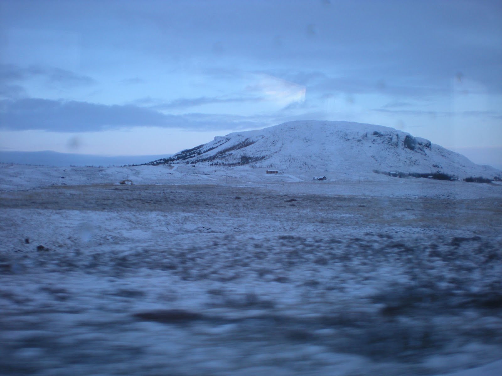
There is no doubt this is a volcanic island.  Once you leave the city limits, you can see ample evidence in the mountains, craters, and steam releasing from the ground.  This island actually straddles two tectonic plates: the North American and the Eurasian. Thus, a little movement here and there, and you have some pretty interesting grumbling below, and then above, the surface.  This shifting does create extraordinary rock formations and natural wonders, along with a handy natural water filtration system. 


Prior to my visit I had visions of the scenery from pictures and from some novels I was reading by the Icelandic author, Halldor Laxness [the only Icelandic Nobel Prize in Literature recipient]. I expected to see a cross between mossy heaths and something out of a J.R.R. Tolkien story.  My expectations were not too far afield.  On one bus trip outside of the city limits, I groggily awoke from a quick doze, and thought I had landed on the moon.  The contrast of the stark white snow with the jet black lava rock in the midst of nothing but sky and clouds astounds the senses. As the sun was setting [early of course], an eerie twilight glow in the sky makes it easy to see why so much of Icelandic myth and lore includes trolls, goblins and elves; long cold periods of darkness could certainly make the sane hallucinate.


The Geyser


This is THE Geyser. The Geysir in Icelandic is the one after which all others are named. In the midst of a snow laden field lies this breathtaking geyser park that may be difficult to fully describe without doing it an injustice. This area is termed a high temperature geothermal zone because the systems exist in a zone of active rifting and volcanic activity with temperatures in the subsurface higher than 200 degrees Celsius at less than 1 kilometer of depth. Unfortunately the actual Geysir doesn't blow any more because in the 1950s some tourists put too many rocks in it and plugged it up; however, the nearby Strokkur [the churn] geyser did not disappoint. Every 7-8 minutes, sometimes with a double expulsion, it erupted.  The rest of the trail winds around several smaller geysers, and colorful little pools of mud and steam, with the not-so-subtle aroma of sulfur.


The Golden Waterfall


Gulfoss is stunning to the ears and eyes. Unfortunately, the snow drifts and cold wind made the viewing and my photos difficult. On a sunny day, though, the sunlight through the falls is supposed to give a golden glow. The pounding rush of the falls feels like a drum through my body; after descending a long staircase, I made a duck walk [it is pretty icy] to the viewing points. The falls cascade over a type of staircase and then bend around to another point and rush into a  100+ foot crevice.  The cascade churns up quite a frothy mist and viewed through the snow drifts, it appears as though it is rushing into the clouds.  This was actually the only point  on the trip I felt unbearably shivering cold. [I am grateful, though, for my new heat-generating thermals!]


Pingvellir/Thingvellir [the Icelandic letter looks like a Olde English P and has a slight th sound]


This National Park is a must-visit place for any geology fan. Because we were racing against daylight at this point of the tour, the pictures were taken in the final hours of twilight.  The photographs also have the added hindrance of large snowflakes.  Despite all of this, this magnificent place instills such a feeling of awe. Thingvellir is a UNESCO site not only because it has one of the few clearly visible fault lines and rift valleys [between the North American and Eurasian tectonic plates], but because it also has the landmark of the world’s first democratic government. 


The Vikings picked this location as the meeting place for their law making body in the year 930. They continued to meet every three years here at the designated Law Rock to discuss the laws and any issues of the day.  This spot remains a sacred site for Iceland; this was the site where, on June 17, 1944, Iceland declared its independence from Denmark and became a republic. 


Additionally, though, this park has rock formations, fissures, and valleys you could spend an entire day hiking. It is also possible to say that you more-or-less traveled from Europe to North America in less than half an hour.  The park has places to view the Almanna Gorge [Everyman’s Gorge], the rift valley [separation between the plates] and also Raven’s Gorge.  Looking out over the rift valley during the last moments of light with the falling snow, I felt this incredible stillness. I have never been to space, but if I were to imagine what it felt like, it would be this. 


The Hot Springs
The Blue Lagoon


Blue Lagoon Spa is like the Disney World tourist attraction of Iceland. Like Disney, it does not disappoint at all.  Although Iceland has many hot spring spas and swimming pools, the lagoon has many unique characteristics.  First of all, the drive out to the spa has scenery that reminded me of a lunar landscape.  There is nothing around except white mountains and dark lava rock sprinkled with snow.  Then, out of nowhere, there is a road leading to the spa, which is built into the lava rock, and the entrance to the milky blue lagoon.


After a shower, you put on your swimsuit, walk outside and immerse yourself into water that looks like it belongs in a witch’s cauldron. The milky blue water has steam coming off it; against the gray clouds, the experience feels quite ethereal.  The water is warm and cozy. You can crab walk your way around the lagoon to stay immersed. Find one of the buckets with the white silica mud and slather it over your face, neck and shoulders. Continue your crab-cruise around the lagoon and feel your toes either squishing into soft sediment or resting on the hard lava rock.  At several places in the lagoon you can feel burst of geothermal currents, too. 


moss at Geysir to give you the idea
The lava around the area was created in 1266 [not a typo] and was called evil lava because it was so darn hard. In the summer it is covered by beautiful moss.  Although it was covered by cold snow on this visit, the scenery was still beautiful, especially as the sun set.  The lagoon actually sits between the two tectonic plates, so the water that is churned up from the center of the earth, a primordial algae, mineral, and silica soup, is pretty old, and apparently good for your skin. The water recycles every 40 hours and no bacteria can live in it, so nothing else is added to it. I never learned exactly why the water was blue, but it was definitely relaxing.


They do offer in-water massages at the lagoon. You can also indulge in some algae  masks and a volcanic pumice scrub from the 'bar" on the edge of the pool that also serves beer and wine. Outside the lagoon pool you can take in in a sauna and a steam bath.  The entrance to the steam bath room looks like Bilbo Baggins’s front door. You enter the room built into the lava rock and immediately notice the sulfur smell. After a few seconds of relaxing into the caressing heat, you are jolted alive by a burst of steam from the belly of the earth; to say it is hot would be an understatement. After a few hours at the lagoon I felt like every pore and every layer of my skin had been detoxed. I also slept like a rock that night.


Fontana
My second steam bath experience was at the newly opened Fontana hot spring wellness center in a town called Laugurvatn. The town is named after the spring-fed lake and the hot springs and geothermal steam for the spa are right on the lakeshore.  The outdoor pools, one at 32 degrees Celsius and one at 40 degrees Celsius, both have ample views of the lake. The sauna also has a huge glass wall for bathers to view the lake. The day I visited, it was snowing and gray, so the view may be more stunning on a clear day. The steam baths here were definitely hotter with more frequent heat bursts.  They also had a stronger sulfur smell. The entire experience felt relaxing, though, and it kept me warm for the rest of the day. 


Hotel Natura at high noon!
My hotel also had a spa with a little sauna, a steam bath that smelled like lavender [nice!] , and a geothermal heated pool and hot tub. With simple design [think IKEA meets ScanDesign], natural artwork, and mellow music piped in [neither Bjork nor Enya], the whole experience fulfilled its promise to relax.  


Animals
The Norwegians, Dutch, and Danish brought all kinds of animals to Iceland.  They have sheep, cows, pigs, dogs, and cats. (The cats, by the way, genetically link to Ireland, which is where many of the Vikings picked up their women en route to Iceland).  There are more sheep than people on this island, and quite a few cows and horses. The horses are quite cute and stout, and apparently hardy enough to stay outside all winter. They allegedly have their own special gait pattern, too.


Food
In addition to the livestock and obvious abundance of seafood, Iceland has its greenhouses for some of its produce.  The breakfast buffet had a certain European flair to it: 4-minute and 6-minute boiled eggs; ingredients for open-faced sandwiches, including sliced cheese, pate, processed meat, and cheese spread with shrimp or mushrooms; pickled fish; a shot of fish oil; muesli; fruit; skyr (absolutely delicious whipped yogurt); waffles; and beans and franks.  A lunch buffet one day was a good way to taste, without committing, to some unusual pickled salads and overcooked meats.  I will not say my body appreciated some of my commitments, but this is part of the travel fun. I was unable to try the famous lamb hotdogs at the Harbor, or the items on the menu board pictured at left.  I will say, though, that the arctic char, smoked lake trout, and bread are delicious. 


I do have only a reserved thumbs up for the bread baked in the ground that a local art gallery owner in Laugurvatn shared [see pic at right].  If you want to try it yourself, make your bread, put it in a cardboard container, wrap it in a plastic bag and bury it for 24 hours. Icelanders obviously enjoy pastries and sweets; I saw no shortage of bakeries or confectioners here.  They do have these healthy pumpkin sunflower seed cookies I could not get enough of...


Language & Lore
The Vikings settled Iceland in the year 871 plus-or-minus two years. (This is the name of a current exhibit in Reykjavik). The Icelandic language is a separate and distinct language with 32 letters and similar to the language spoken by those early Vikings. It is said that Icelanders could actually understand some of the ancient texts; Norwegians today would not be able to understand them.  Much of the history of the Iceland was written down early on in books known as the sagas, which resemble the tales told in epics like The Odyssey.  Iceland also has great fairy tales of legends and lore, recounting tales of trolls and giants.  One evening the hotel where I stayed hosted a pajama party with hot chocolate and an actor came in and read bedtime stories to us. He read a little from the sagas, and told us about the Icelandic Christmas stories, which have 13 “Christmas Lads” that bring presents in the 13 days prior to Christmas, like Santa Clauses, if the children are good. The storyteller also read a cute children's book about giants, which had a similar thread of animism and a moral, like any good fairy tale should. 


My trip to Iceland felt like a fairy tale.  On the bus ride back to the airport, I watched the sun setting low on the horizon behind the most evocative clouds.  In the opposite direction beneath the slate-grey sky I saw a few boats on the water; then, as if on cue, the clouds parted slightly and a giant rainbow appeared. Fairy tale indeed.

Wednesday, November 23, 2011

Brooklyn 'Hoods Continued: Carroll Gardens


Gratuitous fall foliage picture
On any given Saturday take a stroll down Court Street in the Carroll Gardens neighborhood of Brooklyn and follow your nose inside D'Amicos Coffee Shop. Jockey your way through the customers waiting to buy some of the freshly roasting coffee in the front and head to the back cafĂ©. Here you can order a cappuccino and espresso and sit at little metallic tables and chairs as if you were in a piazza. Dry goods and Italian cooking staples used to line these store walls; now, framed photos of several generations of the D’Amico family and friends adorn the exposed brick walls. This place, like the neighborhood, has quite a history. If you don't believe me, just ask one of the regulars sharing conversation over coffee at the tables.

These regulars are indeed regular. They visit this neighborhood every weekend, even if they don’t live here anymore. They come to their home neighborhood to pick up bread, pastries, meats, pasta, and produce, and while the wife is getting her hair done, the men come to D’Amico’s to drink coffee and talk. These regulars can name the people in the photos–they were actually there when most of the photos were taken. In the middle of a debate over which war was the Great War [it was World War I], one of the regulars did offer to share his perspective of the neighborhood’s history.

The neighborhood now known as Carroll Gardens was named after Charles Carroll, a Revolutionary War veteran and the only Roman-Catholic signer of the Declaration of Independence. Many years passed before Mr. Carroll had the honor of a neighborhood being named after him, though. Back in the day, the area was known as Gowanus and Red Hook. Along with Irish and Norwegian immigrants, Italian immigrants from Calabria and Bari worked the docks at Red Hook or the Brooklyn Navy Yard. The strong Italian influence can be seen even today in the business and street names. In fact, Court Street between Third and Fourth places was recently given a second name--Citizens of Mola Way–in a tribute to the industrious 5,000+ residents of Mola di Bari [a region in Apulia, the heel of the "boot"]. Similarly, in 2009, the neighborhood co-named a section of Henry Street between Sackett and Union Streets--Citizens of Pozzallo Way–in a tribute to the contributions of immigrants from that Sicilian seaside town.


Prior to the Italians, the Native Americans, Dutch, Norwegians, and Irish all had a presence in this area. The Gowanus Creek was dredged and the surrounding swamps were drained to form a navigable inland waterway. This waterway, believe it or not, facilitated the transportation of bodies [we’re assuming corpses here] from Manhattan to Greenwood Cemetery, which forms one of the boundary lines of Carroll Gardens today. Part of the current waterway, the Gowanus canal, has many interesting nicknames due to its unfortunate highly polluted state.

The regular quickly dismissed the blemish of "lavender lake" on an otherwise beautiful palette of a neighborhood. He spoke of an era when children were all born at home, and family and respect were a given. He gave me a list of places to visit, too, along Court Street and Smith Street: Where to go for the best pignolia cookies and cannolis; where to get the best "lard bread;" and where to get a good slice of pie [pizza pie, of course]. The homes in Carroll Gardens are also reputed to have some splendid holiday decorations. So, it looks like another stroll through Carroll Gardens is on the horizon.

Friday, October 28, 2011

Brooklyn 'Hoods Continued: Prospect Park & Park Slope

The Park
 
Prospect Park is Brooklyn's Central Park.  At 585 acres, with a lake, hiking trails, a forest, zoo, Audubon center, and band pavilion, she certainly measures up against her 843-acre rectangular older sister just across the river.  Prospect Park's interior has miles of hiking trails; the car lanes also have dedicated walking and cycling lanes for about 3.3 miles around the inside the park. If you run or cycle counter-clockwise starting at the southern point, prepare yourself for a good uphill stretch.  When they designed the park nearly 150 years ago, the forest and ravine needed some elevation to work with; the path does not disappoint.  For another natural bonus, cycling in from the southeast entrance you can dodge road apples in the bike path left by horses trotting toward the park. Yes, horses have trails in the park, too.

American history lovers should enjoy learning that the location of Prospect Park was the site of the first major contest of the Revolutionary War.  "In late August 1776, the Continental Army under George Washington fortified passes along a section of Flatbush Avenue that now serves as the Park’s Drive." [http://www.prospectpark.org/]  Although this particular battle lacked flair for the history books, in the end, it seemed to work out.  America could freely flourish without interference from across the pond. Part of her flourish resulted in the creation of cool neighborhoods around Prospect Park...

The Slope
 
Each Brooklyn neighborhood has a distinct personality.  Park Slope, just to the west of Prospect Park, has a charm reflected in the residents, the stores, and the restaurants.  Over the years, it has garnered top ranking for its architectural features, quality public schools, dining, nightlife, shopping, access to public transit, green space, quality housing, and safety.  It was also the home of Washington Park where the Brooklyn Dodgers [then the Brooklyn Atlantics] played.  Park Slope's popularity for the family set rivals that of Manhattan's Upper West Side and the two neighborhoods would be neck-and-neck for the number of dogs and strollers per resident on a given Saturday or Sunday morning! The variety of cafes and eateries in addition to the park, are a definite draw even for those without a stroller or leash!
 

Tuesday, October 11, 2011

Grand Central Oyster Bar & Guastavino Tile

Once in a while my life has a moment of synchronicity when everything feels aligned and a sense of peace washes over me.  There is no engraved personal invitation or an explanatory movie trailer prior to these moments; the glorious moment just glides in as a gift and I can choose either to enjoy it or over analyze it.  One such moment recently occurred at an unlikely location: the Grand Central Oyster Bar. The background to this moment is worth elucidating.

One day a couple of years ago, while living on Long Island's south shore, I ran through a nearby neighborhood which has charming historic homes. On one street in particular, nearly every waterfront home is breathtaking; but, as I crossed over a little bridge, a two-story brick Mediterranean-style villa captured my attention. For weeks. I found myself 'in the neighborhood' quite often and even researched it online [it was for sale].  The plain exterior did not do justice to the mesmerizing tiled interior. Aptly named the Tile House, this 4000-square foot home was built in 1912 by Rafael Guastavino, Jr., a name that links to pretty much all of my favorite places in Manhattan. 


Rafael Guastavino Sr. emigrated with his son in 1881 from Barcelona, Spain [Guastavino, Sr was born in Valencia]. Guastavino Sr., a trained architect, became credited as the inventor of the "Guastavino Arch" used in the construction of the New York City subway system. In 1889, he and his son, who had apprenticed under him, founded the Guastavino Fireproof Construction Company.  Guastavino Sr. became known for his tile work, a system in which he adeptly used thin, interlocking tiles with layers of mortar to construct supporting arches.  Remarkably, the company acquired 24 patents for this system during its years of operation. Guastavino Jr. also became famous for his own inventions.  His craftmanship is evident at the Tile House where he even had a separate little structure which housed a kiln for his experiments making tile.  

The Guastavinos influenced thousands of structures and my little blog does not begin to scratch the surface.  Of the many New York structures they influenced, some happen to be my favorite places: 

Alexander Hamilton Custom House [ this building has a Catalonian specialty of stair vaulting; the stairs are constructed using hard burned clay tiles and there are no metal supports]; Carnegie Hall; the Elephant Pavilion at the Bronx Zoo; the Cathedral of St. John the Divine; Grant's Tomb; the Museum of Natural History; and of course, Grand Central Station.

The expansive open space of Grand Central Station feels as relaxing as the Roman Baths that influenced the design. When you step into the entrance way to the Grand Central Oyster Bar, it feels more intimate without feeling claustrophobic. Your eyes cannot resist the aesthetically teasing design that zig-zags its way up the arches and ceilings. When you walk inside the restaurant, besides being overwhelmed by the smell of shellfish, the spaciousness and sensuality is striking.  Neutral toned smooth and textured tiles enhance the comfort created by wood panels on the walls inside the restaurant and the adjacent saloon.  In the main dining area the vaulted ceilings appear to play with light and create a dreamlike atmosphere. This space feels alive and timeless.

The Oyster Bar is almost 100 years old. In late February 1913, the same month Grand Central Station began service, Grand Central Oyster Bar opened its doors for business from patrons who were long distance travelers and commuters.  Over time, though, train travel decreased and the restaurant [and station] fell into disrepair. By 1972 the Oyster Bar was bankrupt and remained empty until 1974 when it was revitalized.  In 1997 the restaurant suffered an immense fire that destroyed the entire restaurant but not the structure.  It was quickly renovated and has continued operating where it reportedly serves about 5 million oysters a year!
After researching the Tile House and then discovering a similar thread of artistry in all these other places that had captivated me, I could not wait to visit the Oyster Bar. Sitting in the main room I could take a moment to really see and feel the details of the design and the space.  What had drawn me to that particular house on Awixa, or what had motivated me to learn more about its architect became irrelevant. What matters is that we follow what we are drawn to and recognize, in the structure of our lives, we are placing our own tiles, in a design unique to us. 

Sunday, October 9, 2011

Governors Island


Although a few locations in Brooklyn and around New York Harbor have amazing unobstructed views of Lady Liberty, without exception, my favorite viewing spot is Governors Island. Accessible only by ferry from June through the end of September, this little 172-acre arts-and-recreation island [103 acres were added in 1912 with landfill excavated from the Lexington Avenue subway line] has a delightful park and 2.2 mile paved pathway, which pedestrians and cyclists circumnavigate for awesome views of three Manhattan boroughs. 
 
Governors Island has been officially recognized as the birthplace of the state of New York in 1624.  Prior to that, of course, a few other sovereigns had dibs on this prime piece of real estate, which also addresses the curiosity of where the name originated.  Due to the plentiful trees like hickory, oak, and chestnut, the natives called the island Pagganck, or "Nut Island."  It was 'purchased' for private use in June 1637 [for two ax heads, a string of beads, and a handful of nails], and called  Nutten Island [translated from Dutch] until 1784, when it was officially named Governors Island by the British who gained control for 'His Majesty's Governors.' 

Fast forward to the War of Independence and the realization that a coastal defense would be helpful in this geographic area.  By 1800 when New York transferred Governors Island to the United States for military use, construction had already begun on forts and defenses.  The island's military importance continued until about 1966, when it became the largest Coast Guard base.  Remnants of this installation, which had about 3,500 residents, remain visible in deserted buildings, placed like tombstones throughout the interior of the island. These creepy deteriorating buildings are an anachronism that detract from the beautiful open space and views along the perimeter.


When the Coast Guard left in 1996, "President Clinton designated 22 acres of the island, including the two great forts, as the Governors Island National Monument." [See nps.gov]  The federal government sold the remaining 150 acres of Governors Island to the people of New York for about a dollar [not much appreciation from the ax-and-beads price....] with the condition that it be used only for public benefit. This condition has created some economic and political debate.  

Without the ability to create casinos, high-priced condominiums, or resorts, the suitable alternative resulted in a great picnic, art, and outdoor space. Dave Matthews has a place to perform and former officers' quarters now house art exhibits along a tree-lined path. Gourmands can come across the harbor to pay $75 for an all-you-can-eat barbecue, or they can bring a picnic and enjoy a good book, like I did.  You can rent bikes or bring your own; you can buy a picnic or bring your own. You can relax in a hammock or an Adirondack chair, or actively explore the old fort and read the occasional placard detailing the island's history.

Monday, September 26, 2011

Red Hook, Brooklyn

Old Rail line 
When I lived in Austin, Texas, two fun bumper stickers were commonly displayed: "Keep Austin Weird" and "78704."  For locals, these slogans represent support for local small businesses and artisans, as well as affirm a type of eclectic bourgeois bohemian lifestyle.  On a recent sightseeing walk through the Red Hook neighborhood of Brooklyn, I am pleasantly reminded of this Austin eccentricity.  


According to Dom, the Made-in-Brooklyn walking tour guide, Red Hook's name derives from the red color of the clay, and the Dutch word for point, which sounds like hook. Accurately named, this neighborhood sits on a point in the New York Harbor, between downtown Brooklyn and Bay Ridge, with views of Governor's Island, Lady Liberty, Manhattan, a smidge of Staten Island, and New Jersey.

Art Gallery

Red Hook could not hide its industrial sea port past even if it wanted to.  Along the wharf artists studios, art galleries, restaurants, and residential lofts have replaced the former warehouses that stored various imports like cotton and coffee. These artisan restaurants and studios also dot the main street.  Down some of the cobbled side streets a visitor can see a community farm, a local brewery [Six Points], a maraschino cherry factory [which pinked up some local bee honey a while back when the bees were partaking a bit too much], a winery [Red Hook Winery], a chocolatier [Cacao Prieto], and a key lime pie shop [Steve's Authentic].
Six Points Brewery


All this local business needs a bit of an economic boost, though, especially for a neighborhood with very limited public transportation. This is where IKEA comes in. Located on the water, IKEA supports its business, and the local community's, by funding the water taxis from Manhattan and shuttle buses from downtown Brooklyn. Of course, you could take the fifteen-minute scenic walking route from the nearest subway stop [I did] and experience the true meaning of industrial neighborhoods en route. 

Back of Fairway & Lofts
Near IKEA is the Long Island answer to Texas's Central Market, a European styled food market: Fairway. In addition to reasonable prices on every type of conceivable cooking ingredient, above the Red Hook Fairway are lofts with the best views of the harbor and the docks.  This former warehouse boasts some spectacular picture windows and has kept some of the structure's original warehouse beams with the warehouse numbers still imprinted upon them.  


View from Lofts

Old beam
Several years ago Red Hook had notoriety for how unsafe it was.  Now, with development and creative businesses sprouting up around the community, this neighborhood provides a peaceful retreat from other overly congested areas of Brooklyn.  You can actually park [for free!] in the IKEA parking lot, and IKEA has added some beautiful green space along the water where you could sit, picnic, and enjoy the waterfront views.  As an added bonus, you can watch Manhattanites racing from IKEA to reach the departing water taxi with their giant rugs, pillows, and kitchen supplies in tow.  Or, just watch the ships in the harbor.


Running Across the Brooklyn Bridge & Manhattan Bridge

From Cadman Plaza /Borough Hall in downtown Brooklyn, a runner can make a beautiful scenic loop over two stunning bridges that span the East River. Despite their close proximity, the Brooklyn and Manhattan bridges share little in common except their termini and life purpose. 


When crossing her on foot, the Brooklyn Bridge  resembles a sophisticated, elegant lady in contrast to the tough "guy" Manhattan Bridge.  Her neutral-toned stone, metal, and rope-like guide wires gracefully connect the span carrying cars and the wooden pedestrian platforms with tons of visitors jockeying for a picture of her. Nearby, the gray-blue steel and concrete, adorned with graffiti tattoos that would make a sailor blush, span the river carrying cars, a few pedestrians, and screeching subway cars.  


The Brooklyn Bridge  has been operating almost twenty-seven years longer than the Manhattan Bridge, and she has a charm and beauty all her own.  Despite the hordes of inconsiderate and clueless people who interrupt the traffic flow on a too-narrow foot path, there is something peaceful about watching the last rays of the setting sun reflect off the New York Harbor and Lady Liberty. How many people have enjoyed such a view for over 100 years?  The Manhattan Bridge has his own appeal. You can run across the bridge on either the north or south side.  The south side pedestrian path has a spectacular view of the Brooklyn Bridge and the Harbor; the north side has a rougher view--certainly not one he wishes to show the lady to the south! Whichever side you choose, it can feel like you have the pedestrian portion of the bridge all to yourself compared to the path across the Brooklyn Bridge.  If you can drown out the subway screech and traffic horns, you practically do.